Digital Divide
You may also read more about my thoughts on the digital divide on the Urban Planning page.
Persona-Relevant Internet Access in Chicago
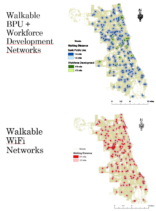 This series of GIS maps shows the locations of persona-relevant public internet sources and their 1/4 and 1/2 mile service areas using the street network to accurately measure walking distance.
The personas include basic public use (internet users of no specific age with no particular agenda), youth, seniors, job seekers, and wi-fi users. These personas all have different needs and may be eligible for different public internet facilities. In addition to the maps there is also a chart showing the percent of Chicago's residential area covered by each persona's service area.
The maps are within a report that was completed for my intermediate GIS course. This report is more of a procedural guide for using ArcMap to accomplish this research method (creating persona-relavant layers of data) than an analysis of my findings about accessible public internet.
The themes of accessibility and social services as they relate to the digital divide are inescapable in this report, for though not much narrative is devoted to their intepretation, the lack of coverage across the city (and on the south side in particular) is readily aparrant.